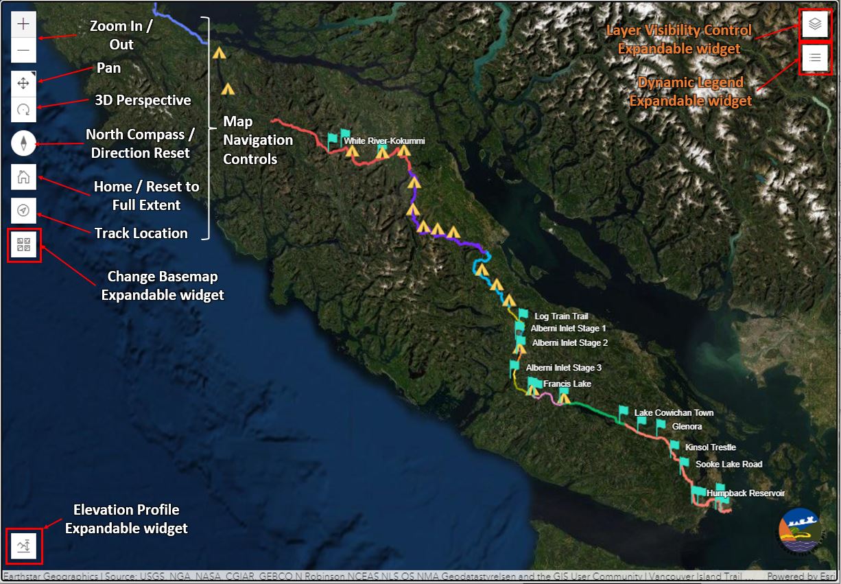
The end product is a stand-alone interactive web-map application usable on Desktop (intended) or mobile browser with the following features:
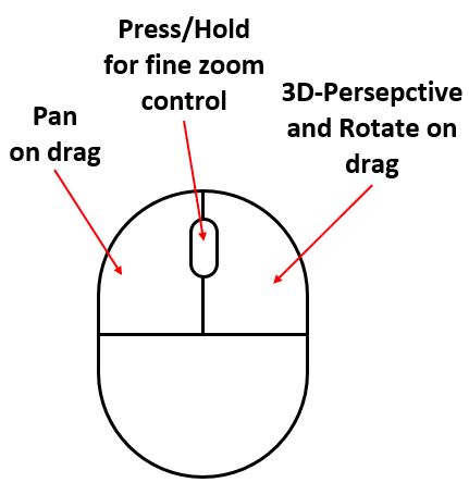
- On-Screen or Mouse (see right image) Navigation controls: Provides user flexibility in viewing trail in desired perspectives (Zoom, Pan, Rotate, 3D perspective, Direction reset, home button, location tracking)
- Changeable Base maps: Flexibility on what surface user may overlay the trail data on
- Elevation Profile and Elevation Data: Useful metrics for planning such as slope, elevation gain, length of a selected or custom sketched profile on the map, in preferred units
- Layer Visibility Control: User controlled visibility Toggle. Zoom / Scale Dependant layering
- Dynamic Legend: Shows feature keys only to visible data within current window extent
- Viewable Attribute Data: Feature attributes and available spatial data upon click
Click on the image below to open the interactive web-map application